Flooding
3.4 Construction of the WEL
The Environment Agency’s first response to any application to construct a bridge over a river is normally to place a condition that the structure must not adversely affect the flow. For this reason, the first option that was considered in the Level 2 SFRA was for an open structure – a ten span viaduct with abutments at each end and nine piers – that stretched right across the flood plain. The hydraulic model analysis for this option showed that predicted flood levels for the 1 in 100-year flood were not altered if this form of construction was chosen.
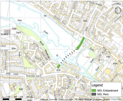
The Level 2 SFRA assessed two other options. The first provided single span bridges over the three river channels in this section of the valley. Between these bridges the WEL would be constructed on an embankment. The hydraulic modelling demonstrated that this option would also satisfy the condition of avoiding interference with the flow in the river. The 1 in 100-year flood levels stayed the same.
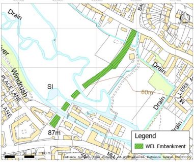
The final option was for a full embankment with restricted openings that would match the size of the opening under the bridge in Bridge Street. There was an intention to keep the flow balanced – matching what came in with what could go out. However, the size of the restricted openings did not consider two additional flows into the area between the WEL and Bridge Street. These were the Hailey Road Drain and a ditch behind properties in Crawley Road that links to Hailey Road Drain. Because of these omissions, more water could flow into the risk area than could escape and the analysis showed that the area between the WEL and Bridge Street still flooded.
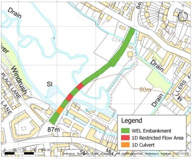
This last option demonstrated that water could be retained upstream of the WEL but identified a problem with the Crawley Road ditch. There is a low bank between this ditch and the flood plain. As the flood plain fills, water will quickly overtop this bank, flow into the ditch and on into the Hailey Road drain. This will add to the flood between the WEL and Bridge Street. In effect, the Crawley Road ditch acts as an outfall from the flood plain which limits the volume that can be retained upstream of the WEL.
The Level 2 SFRA conclusions recognised that further options were possible and stated that “there would be merit in investigating the viability of other more engineered flood alleviation solutions”. WING would strongly support this approach and suggest that an option would be to:
- Include the flow in the Hailey Road drain as part of the volume entering the flood risk area and restrict the openings for the Windrush river channels accordingly. The intended balance of total volume flowing in with the maximum volume that can pass out under the bridge in Bridge Street could then be achieved.
and - Overcome the problem with the Crawley Road ditch by changing the shape of the embankment/dam. The northern end of the dam could be brought round to higher ground to the west of the Crawley Road ditch. This would separate the ditch from the river and allow more water to be retained in the flood plain.
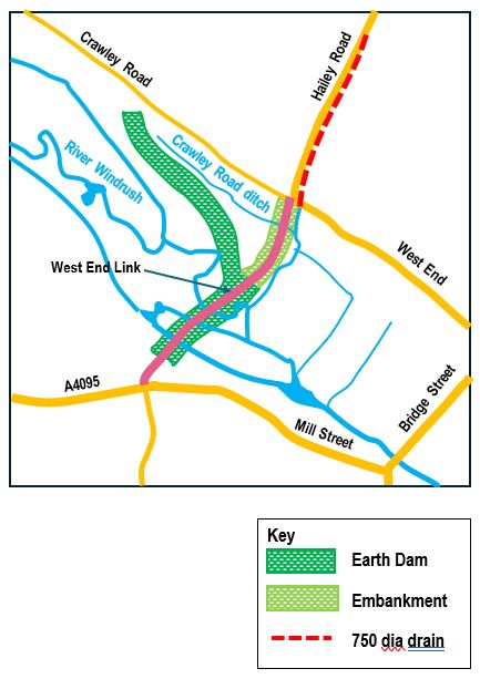
In the diagram above, the earth dam is shown as a dark green shaded strip. Typically, an earth dam is comprised of a clay central core supported by embankment fill. The clay prevents seepage through the dam and extends down in a trench to prevent seepage under the dam.
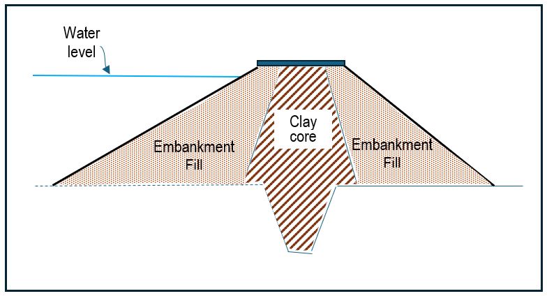
It is possible that the material for construction could be sourced from the flood plain although a full ground investigation will be needed to confirm this. If suitable earthworks materials are found, there are significant benefits:
- Using site-won material avoids the need to import large tonnages of earth and clay in road vehicles. There would be no impact on local traffic and no dirt on Witney’s roads.
- The cost of an embankment solution would be significantly less than the alternative highly engineered 10-span viaduct solution.
- The capacity of the flood plain is increased by the volume of excavated material used to build the dam.